Extras din referat
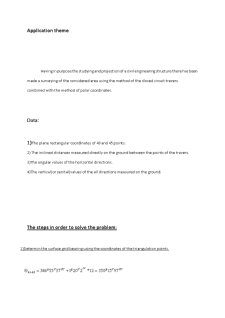
Having in purpose the studying and projection of a civil engineering structure there has been
made a surveying of the considered area using the method of the closed circuit travers
combined with the method of polar coordinates.
Data:
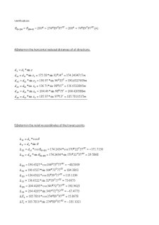
1)The plane rectangular coordinates of 43 and 45 points.
2) The inclined distances measured directly on the ground between the points of the travers.
3)The angular values of the horizontal directions.
4)The vertical(or zenital)values of the all directions measured on the ground.
The steps in order to solve the problem:
1)Determin the surface grid bearing using the coordinates of the triangulation points.
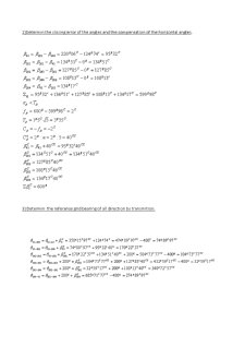
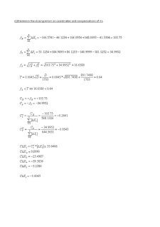
2)Determin the closing error of the angles and the compensation of the horizontal angles.
3) Determin the referance grid bearing of all direction by transmition.
Preview document


Conținut arhivă zip
- Methods Of Planimetric Surveying.doc
Te-ar putea interesa și

Application theme In order to make a corect reprezentation in plan of a topografic surface there are necesary some basic topografic calculus...

Application nb.1 Surveying calculations The ensemble of operations in order to obtain plans and maps is known as surneying.Because during land...